#Typhoon #Nalgae
https://ift.tt/dsWz7wm Note: NOAA is keeping this gif animation up to date but the gif preview provided by Telegram does not evolve with time, thus click the url to watch the auto-updated gif please.
https://ift.tt/dsWz7wm Note: NOAA is keeping this gif animation up to date but the gif preview provided by Telegram does not evolve with time, thus click the url to watch the auto-updated gif please.
#Typhoon #Banyan
https://ift.tt/b9Fcqye Note: NOAA is keeping this gif animation up to date but the gif preview provided by Telegram does not evolve with time, thus click the url to watch the auto-updated gif please.
https://ift.tt/b9Fcqye Note: NOAA is keeping this gif animation up to date but the gif preview provided by Telegram does not evolve with time, thus click the url to watch the auto-updated gif please.
#Typhoon #Yamaneko
https://ift.tt/H0Xecv4 Note: NOAA is keeping this gif animation up to date but the gif preview provided by Telegram does not evolve with time, thus click the url to watch the auto-updated gif please.
https://ift.tt/H0Xecv4 Note: NOAA is keeping this gif animation up to date but the gif preview provided by Telegram does not evolve with time, thus click the url to watch the auto-updated gif please.
#Typhoon #Pakhar
https://ift.tt/7KC9keE Note: NOAA is keeping this gif animation up to date but the gif preview provided by Telegram does not evolve with time, thus click the url to watch the auto-updated gif please.
https://ift.tt/7KC9keE Note: NOAA is keeping this gif animation up to date but the gif preview provided by Telegram does not evolve with time, thus click the url to watch the auto-updated gif please.
#Typhoon #Mawar
https://ift.tt/pYbOxFnNote: NOAA is keeping this gif animation up to date but the gif preview provided by Telegram does not evolve with time, thus click the url to watch the auto-updated gif please.
https://ift.tt/pYbOxFnNote: NOAA is keeping this gif animation up to date but the gif preview provided by Telegram does not evolve with time, thus click the url to watch the auto-updated gif please.
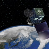
Wednesday, June 28, 2023The PO.DAAC is pleased to announce the public release of Level 2 science data products from the Surface Water and Ocean Topography (SWOT) mission, which launched in December 2022. SWOT is a joint mission between NASA and CNES that aims to measure ocean surface topography with unprecedented resolution and accuracy, as well as map inland water bodies globally. This release includes the Operational Geophysical Data Record (OGDR) and Interim Geophysical Data Record (IGDR) from the Poseidon-3C Nadir Altimeter (NALT), a Jason-class dual-frequency (Ku/C) radar altimeter that operates at 1- and 20-Hz, and the Advanced Microwave Radiometer (AMR), a two-beam passive radiometer that measures sea surface brightness temperatures for three microwave frequencies (18.7, 23.8 and 34 GHz) which are used to correct for altimeter range delays caused by water vapor and liquid water content in the atmosphere.Datasets in this release were acquired for 1-day repeat cycles during the SWOT mission’s calibration/validation phase, which is expected to conclude in July 2023. Data coverage begins with Cycle 559 on June 21, 2023. The NALT datasets provide along-track measurements of sea surface height, significant wave height, and wind speed between 78°N and 78°S latitude. NALT measurements have nominal along-track resolutions of approximately 6 km at 1 Hz and 300 m at 20 Hz. NALT datasets are distributed in two formats for OGDR products and three formats for IGDR products ("SSHA", "GDR", or "SGDR"), as described in the <a href="https://archive.podaac.earthdata.nasa.gov/podaac-ops-cumulus-docs/web-misc/swot_mission_docs/pdd/SALP-ST-M-EA-17043-CN_0103_20220411_Rev1.3.pdf">Product Denoscription Document</a>. The AMR datasets provide raw brightness temperatures, as well as wet troposphere content, atmospheric attenuation to backscatter, cloud liquid water, water vapor content, and wind speed estimates for two tracks located approximately 30 km to the left and right sides of nadir. AMR measurements have nominal along-track resolutions that range between ~23 and 42 km.Datasets included in this release are listed below, with links to the corresponding dataset landing pages on the PO.DAAC web portal (<a href="//podaac.jpl.nasa.gov/swot">https://podaac.jpl.nasa.gov/swot</a>).Poseidon-3C Nadir Altimeter* SWOT_L2_NALT_IGDR_1.0 (<a href="https://doi.org/10.5067/SWOT-NALT-IGDR-1.0">https://doi.org/10.5067/SWOT-NALT-IGDR-1.0</a>)* SWOT_L2_NALT_OGDR_1.0 (<a href="https://doi.org/10.5067/SWOT-NALT-OGDR-1.0">https://doi.org/10.5067/SWOT-NALT-OGDR-1.0</a>)Advanced Microwave Radiometer* SWOT_L2_RAD_IGDR_1.0 (<a href="https://doi.org/10.5067/SWOT-RAD-IGDR-1.0">https://doi.org/10.5067/SWOT-RAD-IGDR-1.0</a>)* SWOT_L2_RAD_OGDR_1.0 (<a href="https://doi.org/10.5067/SWOT-RAD-OGDR-1.0">https://doi.org/10.5067/SWOT-RAD-OGDR-1.0</a>)<strong>Download data using the podaac-subscriber:</strong><em>$ podaac-data-subscriber -c SWOT_L2_NALT_OGDR_1.0 -d ./data/SWOT_L2_NALT_OGDR_1.0 --start-date 2023-06-21T00:00:00Z</em><strong>Resources for users of SWOT datasets distributed by the PO.DAAC</strong>
<a href="https://podaac.github.io/tutorials/quarto_text/SWOT.html">PO.DAAC Cookbook - SWOT Chapter</a> (Selected User Resources)
<a href="https://podaac.github.io/tutorials/quarto_text/DataSubscriberDownloader.html">PO.DAAC Data Subscriber/Downloader</a> (Download Access)
<a href="//podaac.jpl.nasa.gov/animations/Scripted-Access-to-PO.DAAC-Data-in-the-cloud-tutorial">Video tutorial on using the podaac-data-subscriber</a>
Data search
<a href="https://search.earthdata.nasa.gov/search">Earthdata Search Client</a>
<a href="https://search.earthdata.nasa.gov/search">PO.DAAC Cloud Earthdata Search Portal</a>
<a href="https://nasa-openscapes.github.io/2021-Cloud-Workshop-AGU/tutorials/01_Earthdata_Search.html">Earthdata Search tutorial</a>
General information about Earthdata (AWS) cloud
<a href="https://urs.earthdata.nasa.gov/users/new">Obtain Earthdata Login Account</a>
<a href="https://earthdata.nasa.gov/learn/user…