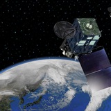
#Typhoon #Doksuri
https://ift.tt/yshltDPNote: NOAA is keeping this gif animation up to date but the gif preview provided by Telegram does not evolve with time, thus click the url to watch the auto-updated gif please.
https://ift.tt/yshltDPNote: NOAA is keeping this gif animation up to date but the gif preview provided by Telegram does not evolve with time, thus click the url to watch the auto-updated gif please.
Wednesday, July 26, 2023The PO.DAAC is pleased to announce the July 31 release of reprocessed Level 1A (L1A), Level 1B (L1B), and Level 2 (L2) altimetry data from the Sentinel-6 Michael Freilich/Jason CS radar altimeter mission. This mission aims to provide high-precision measurements of global sea-level that build upon the extensive record of observations from the previous Jason series altimetry missions. Datasets in this release were processed with the latest Sentinel-6 processing baseline (F08), which has been in use operationally for Non-Time Critical (NTC) datasets generated since February 2023.In the aim of improving the mission long term stability, this F08 baseline provides new data derived from a Numerical Retracker. It presents some processing changes with the update of the altimeter antenna aperture used for the retracking algorithms (from 1.33° to 1.34°) and the update of the coefficient used to compute the ionosphere Total Electron Content (from 0.925 to 0.881, Dettmering and Schwatke [2022]). This reprocessing also brings corrections for missing files and anomalies affecting a small number of passes in the F06/F07 NTC products. More information regarding Sentinel-6 data quality and reprocessing can be found <a href="https://eumetsatspace.atlassian.net/wiki/spaces/SEN6/pages/1621689542/Sentinel-6+data+specifics">here</a>.The reprocessed data included in this release cover the time frame from the start of the mission through present. These new datasets are considered Version F08. The corresponding “Version 2” datasets are retired as of July 31. Users are reminded that they should switch to the datasets listed below to obtain NTC data from PO.DAAC going forward. NRT and STC data will continue to be available through the original datasets released for Version F.The reprocessed datasets can be accessed through NASA <a href="https://search.earthdata.nasa.gov/search?q=JASON_CS_S6A_*_F08">Earthdata Search</a>. They are also accessible via the DOI links listed below, which redirect to the corresponding dataset landing pages on the <a href="//podaac.jpl.nasa.gov/">PO.DAAC Web Portal</a>.
L1A P4 Altimeter High Resolution (HR) NTC Intermediate Outputs with Instrument Calibrations F08 DOI: <a href="https://doi.org/10.5067/S6AP4-1AHNTR-F08">10.5067/S6AP4-1AHNTR-F08</a>
L1B P4 Altimeter Low Resolution (LR) NTC Geolocated Waveforms F08 DOI: <a href="https://doi.org/10.5067/S6AP4-1BLNTR-F08">10.5067/S6AP4-1BLNTR-F08</a>
L1B P4 Altimeter High Resolution (HR) NTC Geolocated Waveforms F08 DOI: <a href="https://doi.org/10.5067/S6AP4-1BHNTR-F08">10.5067/S6AP4-1BHNTR-F08</a>
L2 P4 Altimeter Low Resolution (LR) NTC Ocean Surface Topography (Unvalidated) F08 DOI: <a href="https://doi.org/10.5067/S6AP4-2LSNUR-F08">10.5067/S6AP4-2LSNUR-F08</a>
L2 P4 Altimeter Low Resolution (LR) NTC Ocean Surface Topography F08 DOI: <a href="https://doi.org/10.5067/S6AP4-2LSNTR-F08">10.5067/S6AP4-2LSNTR-F08</a>
L2 P4 Altimeter Low Resolution (LR) NTC Reduced Ocean Surface Topography (Unvalidated) F08 DOI: <a href="https://doi.org/10.5067/S6AP4-2LRNUR-F08">10.5067/S6AP4-2LRNUR-F08</a>
L2 P4 Altimeter Low Resolution (LR) NTC Reduced Ocean Surface Topography F08 DOI: <a href="https://doi.org/10.5067/S6AP4-2LRNTR-F08">10.5067/S6AP4-2LRNTR-F08</a>
L2 P4 Altimeter High Resolution (HR) NTC Ocean Surface Topography (Unvalidated) F08 DOI: <a href="https://doi.org/10.5067/S6AP4-2HSNUR-F08">10.5067/S6AP4-2HSNUR-F08</a>
L2 P4 Altimeter High Resolution (HR) NTC Ocean Surface Topography F08 DOI: <a href="https://doi.org/10.5067/S6AP4-2HSNTR-F08">10.5067/S6AP4-2HSNTR-F08</a>
L2 P4 Altimeter High Resolution (HR) NTC Reduced Ocean Surface Topography (Unvalidated) F08 DOI: <a href="https://doi.org/10.5067/S6AP4-2HRNUR-F08">10.5067/S6AP4-2HRNUR-F08</a>
L2 P4 Altimeter High Resolution (HR) NTC Reduced Ocean Surface Topography F08 DOI: <a href="https://doi.org/10.5067/S6AP4-2HRNTR-F08">10.5067/S6AP4-2HRNTR-F08</a>
L2 Advanced Microwave Radiometer (AMR-C) NTC Geophysical Parameters F08 DOI: <a href="https://doi.org/10.5067/S6AMW…
Forwarded from IFTTT
Near-simultaneous SAR observations over Typhoon Doksuri https://cimss.ssec.wisc.edu/satellite-blog/archives/53709