Typhoon Koinu in the Philippine Sea https://cimss.ssec.wisc.edu/satellite-blog/archives/54830
Typhoon Koinu reaches Category 4 intensity as it approaches Taiwan https://cimss.ssec.wisc.edu/satellite-blog/archives/54897
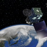
#Typhoon #Bolaven
https://www.ssd.noaa.gov/PS/TROP/floaters/15W/imagery/vis_lalo-animated.gif Note: NOAA is keeping this gif animation up to date but the gif preview provided by Telegram does not evolve with time, thus click the url to watch the auto-updated gif please.
https://www.ssd.noaa.gov/PS/TROP/floaters/15W/imagery/vis_lalo-animated.gif Note: NOAA is keeping this gif animation up to date but the gif preview provided by Telegram does not evolve with time, thus click the url to watch the auto-updated gif please.
Tropical Storm Bolaven forms southwest of Guam https://cimss.ssec.wisc.edu/satellite-blog/archives/54969
Bolaven becomes a typhoon https://cimss.ssec.wisc.edu/satellite-blog/archives/55013
Direct Broadcast imagery from the Guam Antenna of Bolaven https://cimss.ssec.wisc.edu/satellite-blog/archives/55019
SAR wind observations over Super Typhoon Bolaven https://cimss.ssec.wisc.edu/satellite-blog/archives/55066
👍1
Super Typhoon Bolaven reaches Category 5 intensity https://cimss.ssec.wisc.edu/satellite-blog/archives/55069
LIS Observations of lightning within the eyewall of Typhoon Bolaven https://cimss.ssec.wisc.edu/satellite-blog/archives/55093
#Typhoon #Sanba
https://www.ssd.noaa.gov/PS/TROP/floaters/16W/imagery/vis_lalo-animated.gif Note: NOAA is keeping this gif animation up to date but the gif preview provided by Telegram does not evolve with time, thus click the url to watch the auto-updated gif please.
https://www.ssd.noaa.gov/PS/TROP/floaters/16W/imagery/vis_lalo-animated.gif Note: NOAA is keeping this gif animation up to date but the gif preview provided by Telegram does not evolve with time, thus click the url to watch the auto-updated gif please.
Eruption of Klyuchevskaya on the Kamchatka Peninsula https://cimss.ssec.wisc.edu/satellite-blog/archives/55417
Mal forms in the South Pacific https://cimss.ssec.wisc.edu/satellite-blog/archives/55587
Eruption of Mount Marapi in West Sumatra https://cimss.ssec.wisc.edu/satellite-blog/archives/55792
Cyclone Jasper https://cimss.ssec.wisc.edu/satellite-blog/archives/55848
Cyclone Jasper makes landfall in Australia https://cimss.ssec.wisc.edu/satellite-blog/archives/55943
#Typhoon #Jelawat
https://www.ssd.noaa.gov/PS/TROP/floaters/18W/imagery/vis_lalo-animated.gif Note: NOAA is keeping this gif animation up to date but the gif preview provided by Telegram does not evolve with time, thus click the url to watch the auto-updated gif please.
https://www.ssd.noaa.gov/PS/TROP/floaters/18W/imagery/vis_lalo-animated.gif Note: NOAA is keeping this gif animation up to date but the gif preview provided by Telegram does not evolve with time, thus click the url to watch the auto-updated gif please.
FrontpageParametrized Rain Impact Model for SMAP L2 V1.0Link: https://podaac.jpl.nasa.gov/animations/Parametrized-Rain-Impact-Model-for-SMAP-L…This graphic illustrates information gathered from the Parametrized Rain Impact Model for SMAP L2 V1.0
via PO.DAAC https://podaac.jpl.nasa.gov/node/1919
via PO.DAAC https://podaac.jpl.nasa.gov/node/1919
Physical Oceanography Distributed Active Archive Center (PO.DAAC)
Animation: Parametrized Rain Impact Model for SMAP L2 V1.0 | PO.DAAC / JPL / NASA
Animation of the sea surface salinity over the period of 31 March 2015 to 30 September 2021, produced using the Parameterized Rain Impact Model (PRIM) by the University of Central Florida (UCF) Central Florida Remote Sensing Lab (CFRSL), Orlando, FL; University…
👍1
Thursday, December 21, 2023The PO.DAAC is pleased to announce the availability of the PI-produced Parametrized Rain Impact Model (PRIM) for SMAP Level-2 V1.0 dataset produced by the University of Central Florida (UCF) Remote Sensing Lab (CFRSL), Orlando, FL and the University of Washington (UW) Applied Physics Lab (APL), Seattle, WA. This dataset provides sea water salinity on a 0.25-degree spatial grid and covers March 31, 2015 through October 1, 2021. Additional coverage may be provided in the future depending on the availability of required inputs such as rain rate from the IMERG V6B Final Run product.Each PRIM data file corresponds to one JPL SMAP Level 2B CAP Sea Surface Salinity V5.0 file, and contains coverage for one orbit on a given day. Its primary parameters include sea surface salinity at the surface (PRIM_S0m), at 1m depth (PRIM_S1m), and at 5m depth (PRIM_S5m), as well as ocean stratification probability (PSS). The data are distributed in netCDF4 file format and comply with CF/ACDD metadata conventions.The PRIM dataset and user guide are accessible via the dataset landing page on PO.DAAC web portal. Users are recommended to download the data using the podaac-data-subscriber. We also encourage users to visit PO.DAAC Cloud Data Page for detailed information about how to access the data from NASA Earthdata Cloud. General information regarding the SMAP mission is available from the mission website.DOI:10.5067/PRIMS-2RSW1 - https://doi.org/10.5067/PRIMS-2RSW1Citation:Jacob et al. 2023. Parameterized Rain Impact Model near-surface salinity and stratification estimates. Ver. 1.0. PO.DAAC, CA, USA. Dataset accessed [YYYY-MM-DD] at https://doi.org/10.5067/PRIMS-2RSW1.Reference:Drushka, K., Asher, W. E., Ward, B., & Walesby, K. (2016). Understanding the formation and evolution of rain-formed fresh lenses at the ocean surface. Journal of Geophysical Research: Oceans, 121(4), 2673-2689.Related PO.DAAC Animation: https://podaac.jpl.nasa.gov/animations/Parametrized-Rain-Impact-Model-for-SMAP-L2-V1.0Comments/Questions? Please contact podaac@podaac.jpl.nasa.gov or visit the PO.DAAC on Earthdata Forum.
via PO.DAAC https://podaac.jpl.nasa.gov/announcements/2023-12-21-Parametrized-Rain-Impact-Model-for-SMAP-L2-V1.0-Dataset-Release
via PO.DAAC https://podaac.jpl.nasa.gov/announcements/2023-12-21-Parametrized-Rain-Impact-Model-for-SMAP-L2-V1.0-Dataset-Release
Pyrocumulonimbus cloud in Australia https://cimss.ssec.wisc.edu/satellite-blog/archives/56132
Wednesday, January 3, 2024Animation of the GHRSST Level-3 supper-collated (L3S) daily Sea Surface Temperature (SST) v2.81 dataset derived from multiple low earth orbit (LEO) satellites by the NOAA Advanced Clear-Sky Processor for Ocean (ACSPO) system. The dataset can be accessed from the PO.DAAC Portal at https://doi.org/10.5067/GHLDY-3S281 (DOI: 10.5067/GHLDY-3S281).How to Download PO.DAAC Youtube Animations
via PO.DAAC https://podaac.jpl.nasa.gov/animations/GHRSST-L3S-LEO-Daily-SST-v2.81-dataset
via PO.DAAC https://podaac.jpl.nasa.gov/animations/GHRSST-L3S-LEO-Daily-SST-v2.81-dataset
Physical Oceanography Distributed Active Archive Center (PO.DAAC)
GHRSST NOAA/STAR ACSPO v2.81 0.02 degree L3S Daily Dataset from LEO Satellites| Physical Oceanography Distributed Active Archive…
The L3S_LEO_DY-STAR-v2.81 dataset produced by the NOAA Advanced Clear-Sky Processor for Ocean (ACSPO) system derives the Subskin Sea Surface Temperature (SST) from multiple instruments, including the VIIRS onboard the Suomi-NPP, NOAA-20 and NOAA-21 satellites…
Wednesday, January 3, 2024The PO.DAAC is pleased to announce the public release of the NOAA/STAR GHRSST Level 3S (super-collated) version 2.81 SST datasets, produced from the Low Earth Orbiting (LEO) JPSS (NPP, N20, N21), Metop-FG (Metop-A, B C) and NASA (Aqua, Terra) satellites.The L3S-LEO is a family of global multi-sensor L3S gridded 0.02º resolution SST products. The L3S-LEO-PM (afternoon orbit) SST is derived from VIIRSs flown onboard JPSS satellites (NPP, N20 and N21) and MODIS onboard Aqua, by collating individual satellite ACSPO L3U SST data. It comprises 2 daily files, day and night, corresponding to nominal local equator crossing times around 01:30/13:30, respectively. The L3S-LEO-DY (daily) further combines L3S-LEO-PM and AM SSTs, both day and night, from afternoon (PM; NPP, N20, N21, Aqua) and mid-morning orbit (AM; Metop-A, B , C) satellites, plus Terra MODIS between 2000-02-24 and 2021-12-31, into a single daily SST product.The L3S-LEO-PM and DY datasets are produced with the NOAA enterprise Advanced Clear Sky Processor for Ocean (ACSPO) v2.81 SST system, by the NOAA Center for Satellite Applications and Research (STAR). The datasets are formatted as netCDF-4, in compliance with the Group for High Resolution Sea Surface Temperature (GHRSST) Data Processing Specification version 2.0 (GDS2). Detailed information regarding the GHRSST Level 3S products are available from the GHRSST website and also via PO.DAAC’s GHRSST mission webpage.The near-real time (NRT) data are produced with a 3-6 hours latency, and then replaced with Re-ANalysis (RAN) files, within ~2-months. Both datasets are described and discoverable via the PO.DAAC dataset information pages, and accessible via the Cloud OPeNDAP and Harmony API services. We recommend users to download the data with the podaac-data-subscriber python tool.DOI:L3S_LEO_PM-STAR-v2.81 https://doi.org/10.5067/GHLPM-3S281L3S_LEO_DY-STAR-v2.81 https://doi.org/10.5067/GHLDY-3S281References: O. Jonasson, I. Gladkova, A. Ignatov, Y. Kihai, 2022: Towards global daily gridded super-collated SST product from low earth orbiting satellites (L3S-LEO-Daily) at NOAA. SPIE Defense + Commercial Sensing 2022, 12118, https://doi.org/10.1117/12.2620103 O. Jonasson, I. Gladkova, A. Ignatov, Y. Kihai, 2021: Algorithmic improvements and consistency checks of the NOAA global gridded super-collated SSTs from low Earth orbiting satellites ACSPO L3S-LEO. SPIE Defense + Commercial Sensing 2021, 11752, doi.org/10.1117/12.2585819 O. Jonasson, A. Ignatov, V. Pryamitsyn, B. Petrenko, Y. Kihai, 2022: JPSS VIIRS SST Reanalysis Version 3, Remote Sens., 14, 3476. https://doi.org/10.3390/rs14143476 O. Jonasson, A. Ignatov, V. Pryamitsyn, B. Petrenko, Y. Kihai, 2023: NOAA MODIS SST Reanalysis Version 1. Remote Sens., 15(23), 5589; https://doi.org/10.3390/rs15235589Related PO.DAAC Animation: https://podaac.jpl.nasa.gov/animations/GHRSST-L3S-LEO-Daily-SST-v2.81-datasetComments/Questions? Please contact podaac@podaac.jpl.nasa.gov or visit the PO.DAAC on Earthdata Forum.
via PO.DAAC https://podaac.jpl.nasa.gov/node/1922
via PO.DAAC https://podaac.jpl.nasa.gov/node/1922
GHRSST
Home
News Meet us at
GHRSST Talks
GHRSST Symposiums & Science Team Meetings
Integrated SST Data Products
The Group for High-Resolution Sea Surface Temperature (SST) (GHRSST) provides a new generation of
GHRSST Talks
GHRSST Symposiums & Science Team Meetings
Integrated SST Data Products
The Group for High-Resolution Sea Surface Temperature (SST) (GHRSST) provides a new generation of
👍1