Coming soon: CSPP Geo software to create LightningCast probability fields https://cimss.ssec.wisc.edu/satellite-blog/archives/56487
👍1
Tropical Invest 90P in the Coral Sea https://cimss.ssec.wisc.edu/satellite-blog/archives/56584
Tropical Storm Seven in the Coral Sea https://cimss.ssec.wisc.edu/satellite-blog/archives/56658
Large waves over the Central and South Pacific Ocean https://cimss.ssec.wisc.edu/satellite-blog/archives/56651
❤1
Large waves approaching Hawai’i https://cimss.ssec.wisc.edu/satellite-blog/archives/57187
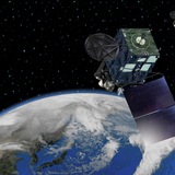
Wednesday, February 28, 2024The Surface Water and Ocean Topography (SWOT) project is pleased to announce the public release of Level 2 Geophysical Data Record products from the onboard nadir altimeter (NALT) and the advanced microwave radiometer (AMR).This release includes the Geophysical Data Record (GDR) from each of the NALT and AMR instruments. The onboard NALT is a Jason-class dual frequency (Ku/C) altimeter. The onboard AMR is also a Jason-class radiometer but with two active strings that facilitate measurements on the left and right sides of the satellite nadir point.Product denoscription documents for these products can be found online at:
<a href="//podaac.jpl.nasa.gov/swot?tab=datasets">https://podaac.jpl.nasa.gov/swot?tab=datasets</a>
<a href="https://www.aviso.altimetry.fr/en/missions/current-missions/swot.html">https://www.aviso.altimetry.fr/en/missions/current-missions/swot.html</a>
The datasets in this release include Cycles 400 to 578 (January 15 – July 10, 2023) during the SWOT commissioning and calibration phases (1-day repeat orbit), and Cycles 1-6 (July 21 – November 23, 2023) during the science phase (21-day repeat orbit). Note that some passes are not available in the later portion of cycle 578, and very early portions of Cycles 402 and 1 during orbit transitions as well as instrument turn on.Starting with this release, NALT and AMR GDR products will continue to be routinely released with a latency of < 90 days from the end of each repeat cycle.Users are advised of the following known limitations in the dataset:
The adaptive retracker has not yet been calibrated, so the adaptive retracker variables should be used with caution.
Users are advised of the following upcoming changes in the datasets:
In the coming weeks, the processing baseline of the SWOT L2 Nadir altimeter products will evolve to use the same MSS (CNES_CLS_2022) and the same MDT (CNES_CLS_2022) as the SWOT KaRIn L2_LR_SSH products.
Users are also advised of the following differences between OGDR, IGDR and GDR:
The OGDR is a non-validated product that is available with a typical latency of < 7 hours.
The IGDR is a partially validated product that is available with a typical latency of < 2 days.
The GDR is a validated product that will become available with a typical latency of < 90 days after the start of release.
See <a href="//podaac.jpl.nasa.gov/SWOT-Level2-Nadir-Altimeter-and-Advanced-Microwave-Radiometer-Data-Product-Specifications">SWOT Level 2 Nadir Altimeter and Advanced Microwave Radiometer Data Product Specifications (Provenance of auxiliary data in OGDR, IGDR, and GDR products and Altimeter retracker outputs in OGDR, IGDR, and GDR)</a> The NALT and AMR data products in this release are accessible at both NASA’s PO.DAAC and CNES AVISO distribution centers. Information on accessing these data is provided below.CNES AVISOThe SWOT Nadir Altimeter and Radiometer (O/I)-GDR products can be accessed on the AVISO+ web portal and through a new platform of the AVISO+ CNES Data Center's long-term archive catalog, accessible directly using AVISO+ credentials. Further information on SWOT data access can be found via the dedicated webpage on AVISO+: <a href="https://www.aviso.altimetry.fr/en/missions/current-missions/swot/access-to-data.html">https://www.aviso.altimetry.fr/en/missions/current-missions/swot/access-to-data.html</a>The GDR products in this release are listed below along with the corresponding Digital Object Identifier (DOI) landing pages:Poseidon-3C Nadir Altimeter
SWOT_L2_NALT_GDR (DOI: <a href="https://doi.org/10.24400/527896/a01-2023.009">10.24400/527896/a01-2023.009</a>)Advanced Microwave Radiometer
SWOT_L2_RAD_GDR (DOI: <a href="https://doi.org/10.24400/527896/a01-2023.010">10.24400/527896/a01-2023.010</a>)NASA PO.DAACThe datasets in this release are listed below with links to the corresponding dataset landing pages on the PO.DAAC web portal (<a href="//podaac.jpl.nasa.gov/swot">https://podaac.jpl.nasa.gov/swot</a>).Poseidon-3C Nadir Altimeter
SWOT_L2_NALT_GDR_2.0…
Physical Oceanography Distributed Active Archive Center (PO.DAAC)
Surface Water and Ocean Topography (SWOT) | PO.DAAC / JPL / NASA
Mission Objectives: The Surface Water and Ocean Topography (SWOT) mission aims to provide valuable data and information about the world's oceans and its terrestrial surface water such as lakes, rivers, and wetlands. SWOT is being developed jointly by NASA…
LightningCast products with Himawari-9 data https://cimss.ssec.wisc.edu/satellite-blog/archives/57502
Tuesday, March 5, 2024Animation of the retrieved ocean surface wind speed over the period of 1 August 2018 to 20 February 2024, produced using the CYGNSS Level 3 Science Data Record (SDR) Version 3.2 dataset, which provides wind speed data retrieved from the Delay Doppler Mapping Instrument (DDMI) aboard the CYGNSS satellite constellation. The dataset can be accessed from the PO.DAAC Portal at https://doi.org/10.5067/CYGNS-L3X32 (DOI: 10.5067/CYGNS-L3X32).How to Download PO.DAAC Youtube Animations
via PO.DAAC https://podaac.jpl.nasa.gov/animations/Ocean-Surface-Wind-Speed-from-CYGNSS-L3-SDR-V3.2-2018-2024
via PO.DAAC https://podaac.jpl.nasa.gov/animations/Ocean-Surface-Wind-Speed-from-CYGNSS-L3-SDR-V3.2-2018-2024
Physical Oceanography Distributed Active Archive Center (PO.DAAC)
CYGNSS Level 3 Science Data Record Version 3.2| Physical Oceanography Distributed Active Archive Center (PO.DAAC)
This dataset contains the version 3.2 CYGNSS level 3 science data record which provides the average wind speed and mean square slope (MSS) on a 0.2x0.2 degree latitude by longitude equirectangular grid obtained from the Delay Doppler Mapping Instrument aboard…
Pyrocumulonimbus clouds in China https://cimss.ssec.wisc.edu/satellite-blog/archives/57772
Changes in the LightningCast domain for Guam https://cimss.ssec.wisc.edu/satellite-blog/archives/58071
Explosive eruption of Mount Ruang in Indonesia https://cimss.ssec.wisc.edu/satellite-blog/archives/58563
Explosive eruption of Mount Ruang in Indonesia https://cimss.ssec.wisc.edu/satellite-blog/archives/58850
Singapore Airlines Flight SQ321 encounters severe turbulence https://cimss.ssec.wisc.edu/satellite-blog/archives/59382
#Typhoon #Ewiniar
https://www.ospo.noaa.gov/Products/ocean/tropical/floaters/01W/imagery/vis_lalo-animated.gif Note: NOAA is keeping this gif animation up to date but the gif preview provided by Telegram does not evolve with time, thus click the url to watch the auto-updated gif please.
https://www.ospo.noaa.gov/Products/ocean/tropical/floaters/01W/imagery/vis_lalo-animated.gif Note: NOAA is keeping this gif animation up to date but the gif preview provided by Telegram does not evolve with time, thus click the url to watch the auto-updated gif please.
👍1
Using LightningCast Probabilities as an aviation tool https://cimss.ssec.wisc.edu/satellite-blog/archives/59748
Tuesday, July 16, 2024The PO.DAAC is pleased to announce the public release of the Cyclone Global Navigation Satellite System ( CYGNSS) data products from the CYGNSS science team including level 1 calibrated raw IF v1.0 dataset, level 2 surface heat flux v3.2 dataset, level 3 ocean microplastic concentration v3.2 dataset, level 3 soil moisture v3.2 dataset and monthly watermask v3.1 dataset from UC Berkeley. The datasets are provided in netCDF-4 format and extend from 1 August 2018 to the present with an approximate 6 day latency, and additional denoscriptions of the data products are documented below:<a href="//podaac.jpl.nasa.gov/dataset/CYGNSS_L1_CAL_RAW_IF_V1.0">L1 Calibrated Raw IF v1.0</a> – This dataset is produced by the CYGNSS Science Team of the University of Michigan, and it contains the first release, Version 1.0, of the CYGNSS Calibrated Raw Intermediate Frequency (IF) based L1 Product. This product includes several established signal coherence detectors, including the power-ratio Pratio, complex zero-Doppler delay waveform and full entropy Efull, and a novel fast entropy detector Efast. Both entropy detectors are provided with two temporal resolutions: 2 ms and 50 ms. Several scattered signal strength products are included in the dataset.<a href="//podaac.jpl.nasa.gov/dataset/CYGNSS_L2_SURFACE_FLUX_V3.2">L2 Ocean Surface Heat Flux V3.2</a> – This dataset provides time-tagged and geolocated ocean surface heat flux parameters with 25x25 kilometer footprint resolution from the Delay Doppler Mapping Instrument (DDMI) aboard the CYGNSS satellite constellation. The reported sample locations are determined by the specular points corresponding to the Delay Doppler Maps (DDMs). Version 3.2 uses CYGNSS Level 2 (L2) Science Data Record (SDR) Version 3.2 surface wind speeds and ECMWF Reanalysis, Version 5 (ERA5).<a href="//podaac.jpl.nasa.gov/dataset/CYGNSS_L3_SOIL_MOISTURE_V3.2">L3 Soil Moisture V3.2</a> – This dataset is produced by the CYGNSS Science Team of the University of Michigan, it is derived from <a href="https://doi.org/10.5067/CYGNS-L1X32">version 3.2 of the CYGNSS L1 SDR dataset</a> and provides volumetric water content estimates for soils between 0-5 cm depth at a 6-hour discretization for most of the subtropics. The data are archived in daily files in netCDF-4 format. Volumetric soil moisture water content in units of cm3/cm3 is provided with two gridding resolutions, 9x9 km and 36x36 km.<a href="//podaac.jpl.nasa.gov/dataset/CYGNSS_L3_MICROPLASTIC_V3.2">L3 Ocean Microplastic Concentration V3.2</a> – This dataset contains the version 3.2 CYGNSS Level 3 ocean microplastic concentration data record, which provides microplastic concentration on a daily temporal and 0.25-degree latitude/longitude spatial grid with 30-day, 1 degree latitude/longitude feature resolution, as constrained by the binning and spatiotemporal averaging of the Mean Square Slope (MSS) anomaly. Version 3.2 uses CYGNSS MSS measurements that are derived from updated v3.2 Level 1 scattering cross section data and has updated the parameterizations in the data processing algorithm to use v3.2 data correctly.<a href="//podaac.jpl.nasa.gov/dataset/CYGNSS_L3_UC_BERKELEY_WATERMASK_V3.1">L3 Monthly Watermask V3.1</a> - This dataset was developed by CYGNSS investigators in the Department of Civil and Environmental Engineering at the University of California, Berkeley. It is derived from <a href="https://doi.org/10.5067/CYGNS-L1X31">version 3.1 of the CYGNSS L1 SDR dataset</a>, and provides monthly binary inland surface water classification data at a 0.01-degree (~1x1 kilometer) resolution with a 1-month latency. This product, known as the UC Berkeley Random Walk Algorithm WaterMask from CYGNSS (Berkeley-RWAWC), generates water classification for a given location based on CYGNSS observations combined with a random walker algorithm. The watermask variable includes binary values indicating land (0), surface water (1), and no data/ocean (-99).The CYGNSS datasets and documents are accessible via the dataset…
❤1
FrontpageCYGNSS Level 2 Ocean Surface Heat Flux Science Data Record Version 3.2Link: https://podaac.jpl.nasa.gov/animations/CYGNSS-L2-SURFACE-FLUX-V3.2This graphic illustrates information gathered from the CYGNSS L2 Surface Flux V3.2 dataset
via PO.DAAC https://podaac.jpl.nasa.gov/node/1970
via PO.DAAC https://podaac.jpl.nasa.gov/node/1970
Physical Oceanography Distributed Active Archive Center (PO.DAAC)
Animation: CYGNSS Level 2 Ocean Surface Heat Flux Science Data Record Version 3.2 | PO.DAAC / JPL / NASA
Animation of the calculated ocean surface latent (top) and sensible (bottom) heat fluxes over the period of 1 August 2018 to 8 June 2024, produced using the CYGNSS Level 2 Ocean Surface Heat Flux Climate Data Record Version 3.2, which provides the time-tagged…
❤1
Monday, July 22, 2024The PO.DAAC is pleased to announce the public release of the Cross-Calibrated Multi-Platform Winds Level 4 Version 3.1 datasets produced by Remote Sensing Systems (RSS). CCMP produces gridded products that provide a consistent, gap-free time-series of vector winds over the world's oceans from 1993 onward. It combines ocean surface 10m wind retrievals from multiple types of satellite microwave sensors (most of the wind-sensing U.S., Japanese, and European satellites flown to date) with a background field from reanalysis (ERA5). After a hiatus, the updated version of these collections are returning to PO.DAAC. The previous version hosted at PO.DAAC was funded under the Making Earth System Data Records for Use in Research Environments (MEaSUREs) project. The most recent version here is produced under an Ocean Vector Winds Science Team grant (ROSES proposal 17-OVWST-17-0023). More information regarding the CCMP project is available on RSS’s webpage at https://www.remss.com/measurements/ccmp/ and also via PO.DAAC’s designated project page.Several enhancements over the previous V2.0 release are implemented including: Use of a more up-to-date and regularly updated reanalysis product for the background wind field. ERA5 was chosen because it is available hourly, facilitating a future enhancement to CCMP for higher frequency analysis. Improved performance and agreement with satellite winds at high wind speed. Minimized spurious trends caused by the interaction between the amount of satellite measurements available and the satellite/model biases. Version 3.1 further improves over version 3.0 by improving the quality of the wind after 2012, see their webpage for details.Datasets comprising this release include 6-hourly and monthly-mean products, spanning 1993 onward. Both are Level 4, near global coverage (between 80° N/S latitude) at 0.25° resolution. Data are produced in netCDF format. The time record will be added onto as files become available (roughly three month latency).The RSS CCMP Winds Level 4 Version 3.1 datasets are described and discoverable via the PO.DAAC data portal, specifically https://podaac.jpl.nasa.gov/dataset/CCMP_WINDS_10M6HR_L4_V3.1 https://podaac.jpl.nasa.gov/dataset/CCMP_WINDS_10MMONTHLY_L4_V3.1Several animations from CCMP winds (wind vectors overlain on sea surface temperature) are available on PO.DAAC’s CCMP project page from the previous version of CCMP. The animations are from previous versions but are still relevant for a first look at CCMP products.DOI: CCMP_WINDS_10M6HR_L4_V3.1 (10.5067/CCMP-6HW10M-L4V31) CCMP_WINDS_10MMONTHLY_L4_V3.1 (10.5067/CCMP-MW10M-L4V31)Citation:Mears, C.; Lee, T.; Ricciardulli, L.; Wang, X.; Wentz, F. 2022. Improving the Accuracy of the Cross-Calibrated Multi-Platform (CCMP) Ocean Vector Winds, Remote Sens., 14, 17. https://doi.org/10.3390/rs14174230Atlas, R., Hoffman, R. N., Ardizzone, J., Leidner, S. M., Jusem, J. C., Smith, D. K., & Gombos, D. 2011. A cross-calibrated, multiplatform ocean surface wind velocity product for meteorological and oceanographic applications, Bull. Amer. Meteor. Soc., 92, 2. https://doi.org/10.1175/2010BAMS2946.1Comments/Questions? Please contact podaac@podaac.jpl.nasa.gov or visit the PO.DAAC on Earthdata Forum.
via PO.DAAC https://podaac.jpl.nasa.gov/announcements/2024-07-22-RSS-Cross-Calibrated-Multi-Platform-Winds-L4-V3.1-Dataset-Release
via PO.DAAC https://podaac.jpl.nasa.gov/announcements/2024-07-22-RSS-Cross-Calibrated-Multi-Platform-Winds-L4-V3.1-Dataset-Release
#Typhoon #Gaemi
https://www.ssd.noaa.gov/PS/TROP/floaters/05W/imagery/vis_lalo-animated.gif Note: NOAA is keeping this gif animation up to date but the gif preview provided by Telegram does not evolve with time, thus click the url to watch the auto-updated gif please.
https://www.ssd.noaa.gov/PS/TROP/floaters/05W/imagery/vis_lalo-animated.gif Note: NOAA is keeping this gif animation up to date but the gif preview provided by Telegram does not evolve with time, thus click the url to watch the auto-updated gif please.
Direct Broadcast imagery of a tropical system north of Guam https://cimss.ssec.wisc.edu/satellite-blog/archives/60543
👍1